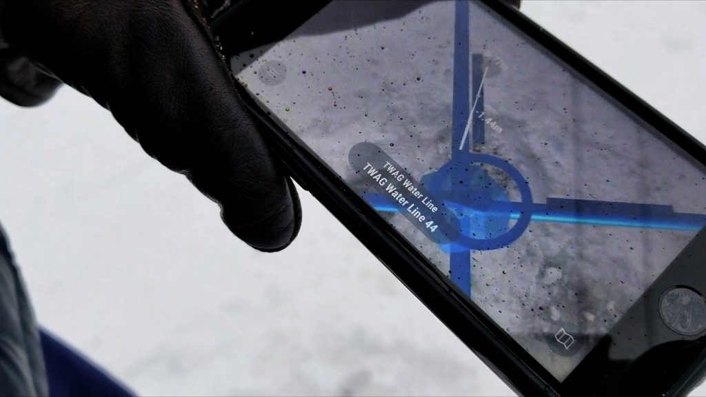
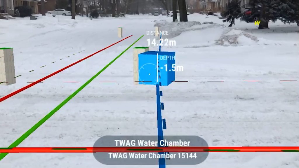
Working on subsurface infrastructure in harsh conditions—snow, mud, or freezing temperatures—is a constant challenge for field teams. Efficiency drops, safety concerns escalate, and traditional methods relying on surface markers, paint, and manual surveys often fail to deliver reliable results.
Using accurate digital records established by vGIS makes GIS network data easily accessible. Teams can simplify locates and streamline documentation, delivering reliable results no matter how extreme the weather using advanced augmented reality.
The Challenges of Locating Utilities in Difficult Conditions
Snow, ice and mud create tough conditions for field crews:
- Obscured Infrastructure: Snow can bury markers, manhole covers, and landmarks, making it difficult to identify access points or follow existing maps.
- Increased Safety Risks: Icy terrain, obscured utilities, and miscommunications in the field can lead to accidents or unintentional damage to underground services.
- Documentation Issues: Adverse conditions obscure markings and complicate as-built documentation, making future maintenance or expansion projects even more difficult.
These challenges not only increase the time and cost of projects but also introduce risks that can disrupt entire communities.

The vGIS Advantage: Enhanced Utility Locating with AR and Digital Twins
vGIS overcomes these barriers by combining augmented reality (AR) and digital twins to deliver precise visualization and actionable insights in even the harshest environments.
- AR for Real-Time Visualization: Field teams can “see” underground utilities overlaid on the actual environment through AR, eliminating guesswork and preventing accidental damage.
- Enhanced Workflow Integration: With seamless compatibility with Esri ArcGIS and GE SmallWorld, vGIS ensures smooth adoption and improved communication between field and office teams.
Adrian Thompson, a veteran in the field, summarized the impact of this technology: “If 10 years ago you told me an operator and/or their spotter could see what services were underground regardless of the conditions, I would have laughed… This is profound for so many applications.”
Locate Documentation: Future-Proofing Projects
Winter conditions often hinder the creation of accurate as-built documentation. However, vGIS ensures that every detail is captured, regardless of the weather. vScan (vGIS’s 3D Scanning software) generates precise records that are easy to access and share. The 3D models and oriented images of the completed site provide future teams with reliable data for excavations and reapplying paint.
Comprehensive documentation also supports compliance with industry standards and regulations, reducing liability and ensuring long-term project success.

The Benefits of Accessible Locating Practices
Adopting accessible technologies like vGIS and vSite offers a range of advantages:
- Improved Accuracy: AR overlays and digital twins ensure the reliability of utility locates, even in adverse weather.
- Enhanced Safety: By reducing time spent on-site and minimizing physical probing, teams can avoid many winter-related hazards.
- Increased Efficiency: Streamlined workflows eliminate delays caused by snow, ice, or equipment failures.
- Better Communication: Real-time data sharing bridges gaps between field and office teams.
- Future-Ready Documentation: High-quality records simplify future maintenance and reduce project costs over time.
A Case for Change
As the industry continues to expand its infrastructure, the challenges posed by poor weather are unlikely to disappear. Instead of accepting delays, risks, and inefficiencies as inevitable, utility companies and locators can leverage accessible locating practices to work smarter.
In the words of Adrian Thompson, “This is profound for so many applications.” To ensure your projects stay on track, no matter the weather, it’s time to embrace tools like vGIS. Transform how you locate utilities this winter—because safety, efficiency, and reliability shouldn’t freeze with the ground.
