System Highlights
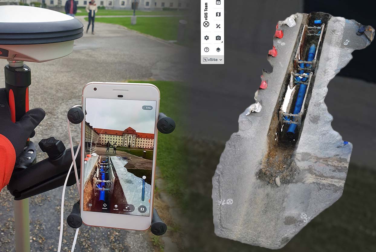
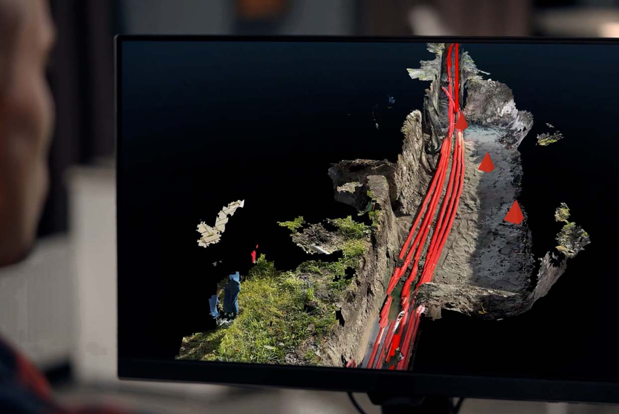
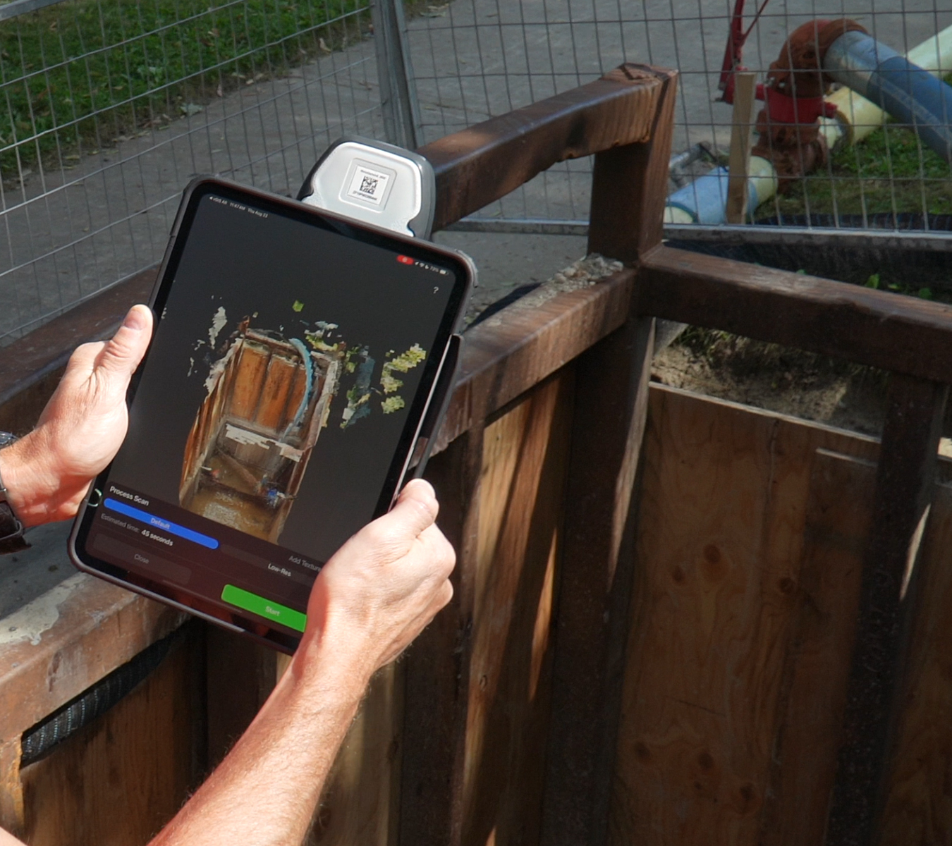
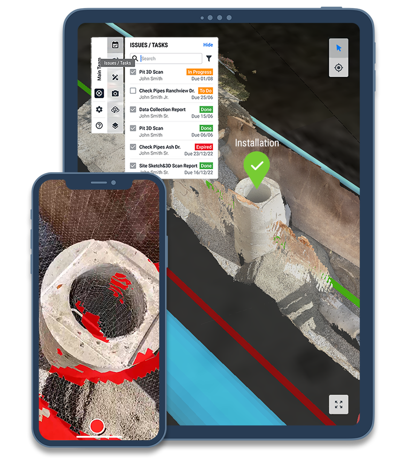
Simplify Job Site Documentation. With vSite, documenting your job site is faster and easier than ever. Use a single platform to collect site-scale point clouds and small trench scans, record GIS data and capture oriented images and 360° imagery.
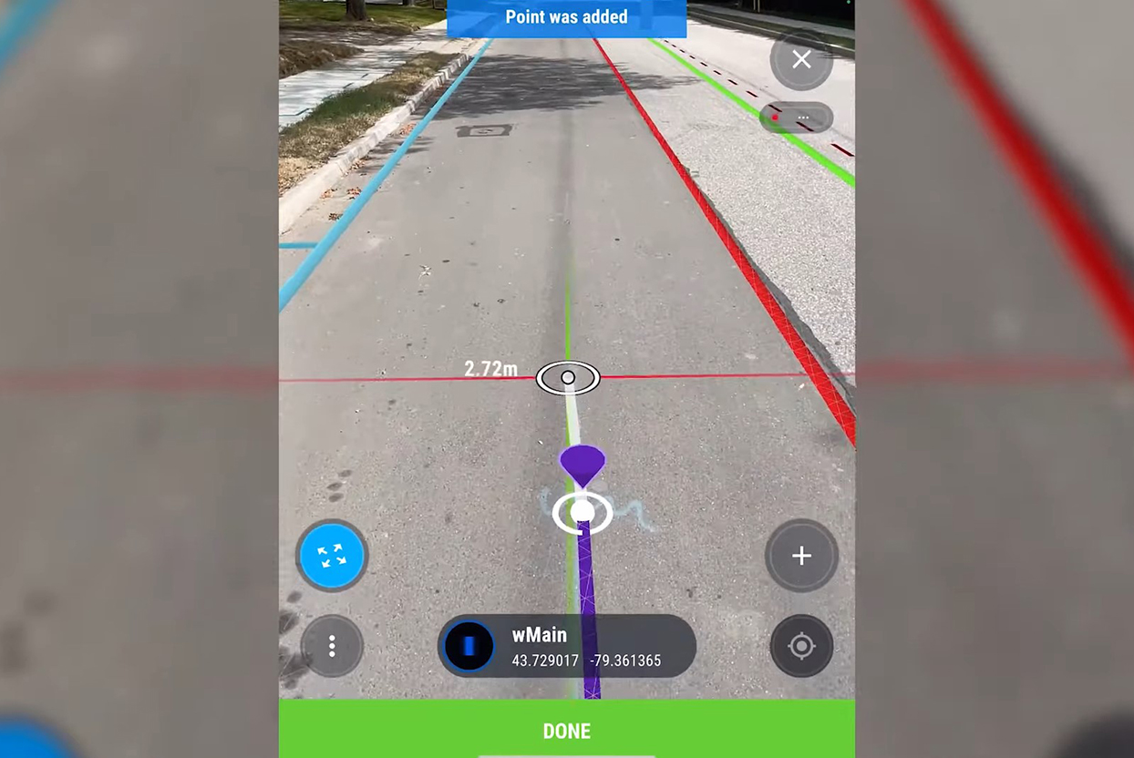
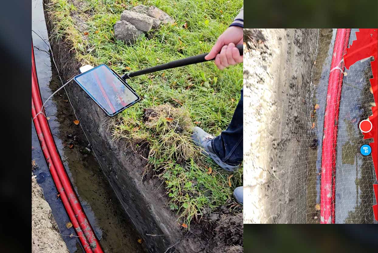
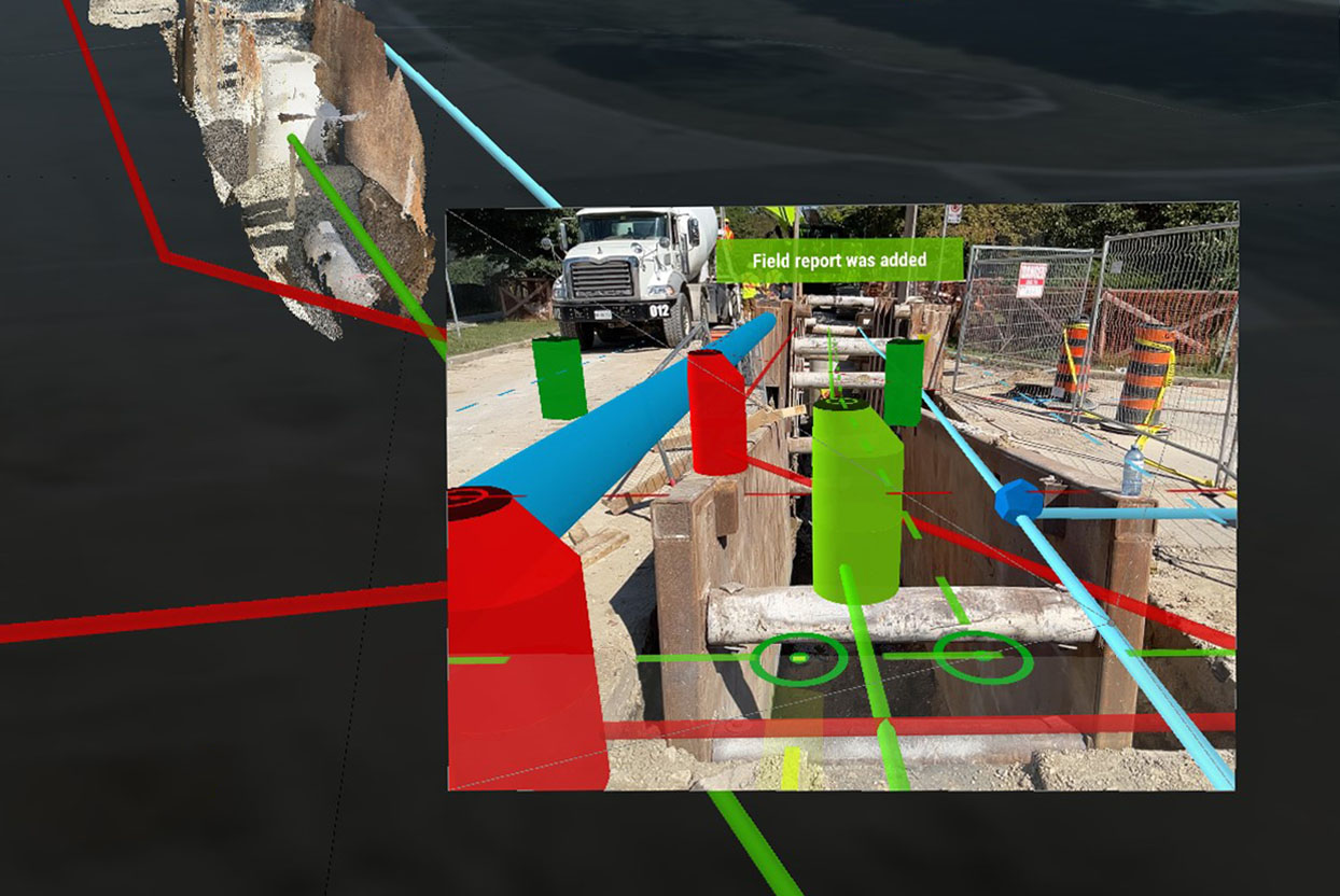
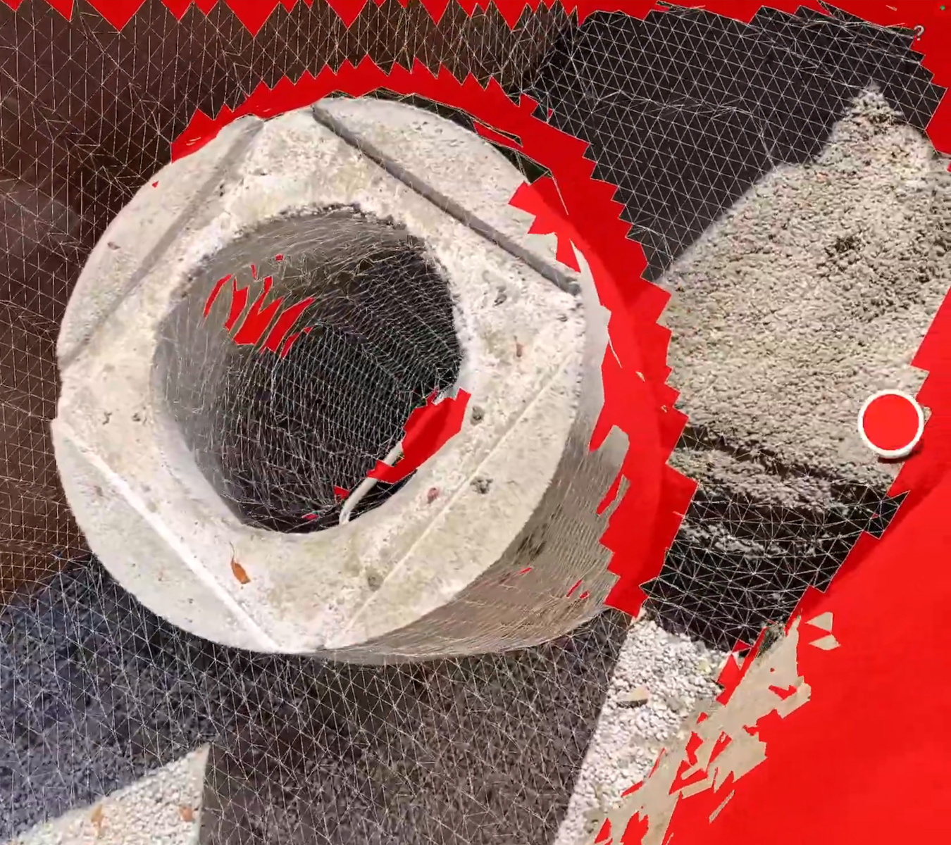
User-Friendly for Everyone. Designed for non-technical users, vSite allows you to collect highly accurate data with a single button push. Then, data accuracy can be instantly validated using augmented reality to reduce reliance on surveyors for tasks that don’t require specialized expertise.
Flexible Integration. Prefer other surveying tools? No problem! vSite integrates with software like Esri Field Maps and Leica Zeno Mobile. Collect data using your preferred tool, switch to vSite AR to inspect and validate the accuracy of your data—in one session without any extra preparation.