Documentation and Reporting for Locates
Simplify and accelerate utility locates with a powerful productivity tool tailored for the industry. Document locate jobs in minutes and instantly share detailed, professional reports with your clients.

Simplify and accelerate utility locates with a powerful productivity tool tailored for the industry. Document locate jobs in minutes and instantly share detailed, professional reports with your clients.
vSite is your all-in-one solution for utility locates, documentation, and reporting:
Explore the case study below to see how vGIS delivers real-life benefits.
| Industry Case Study |
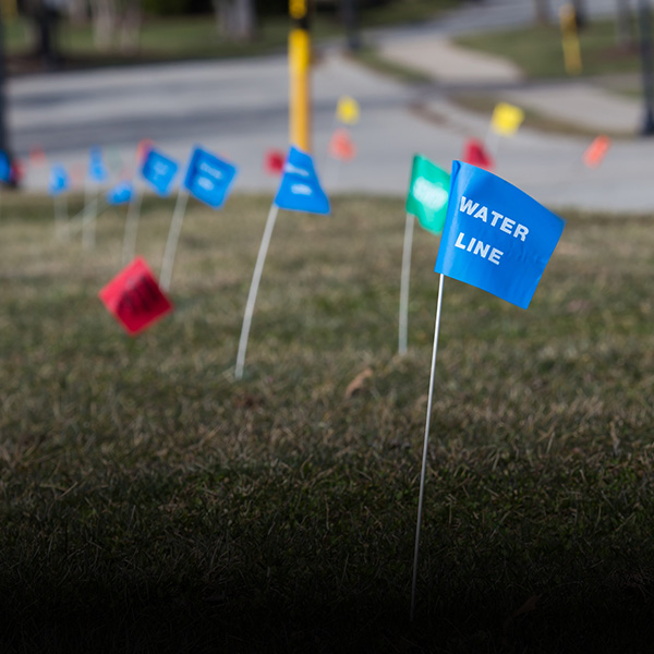
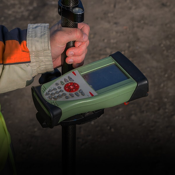
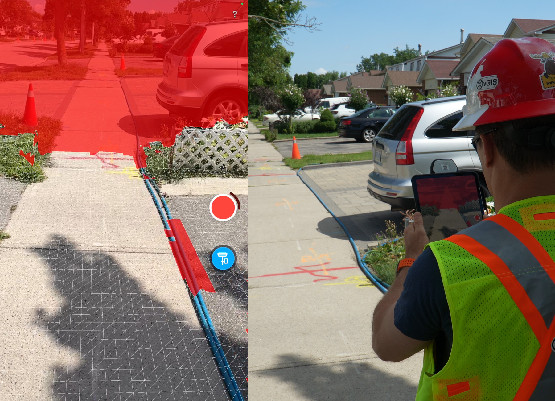
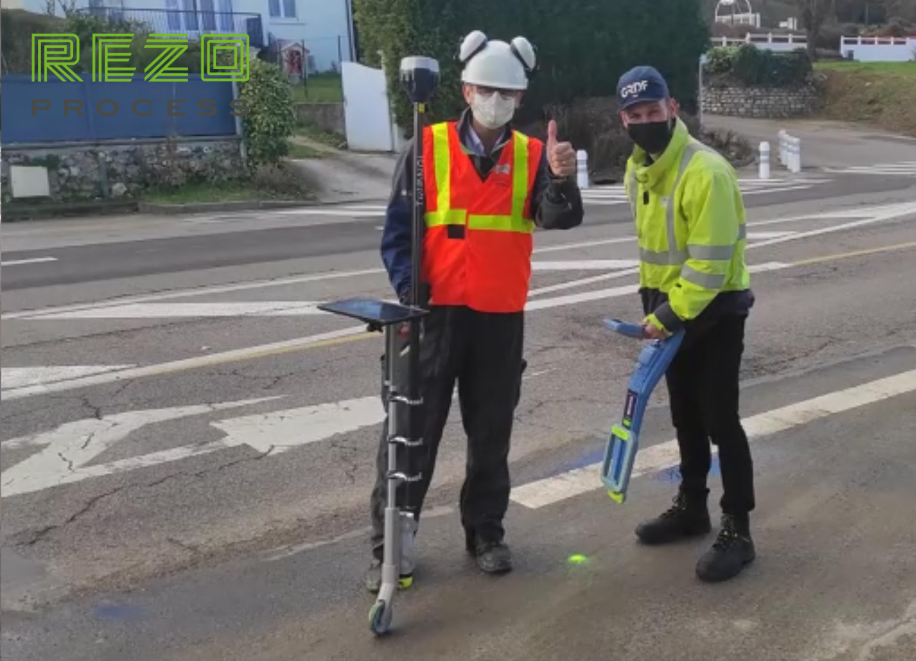
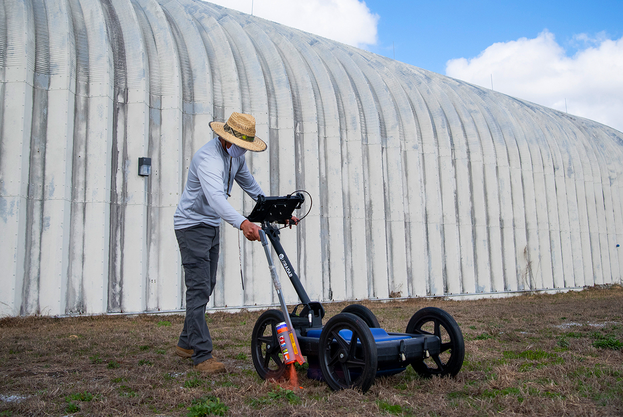
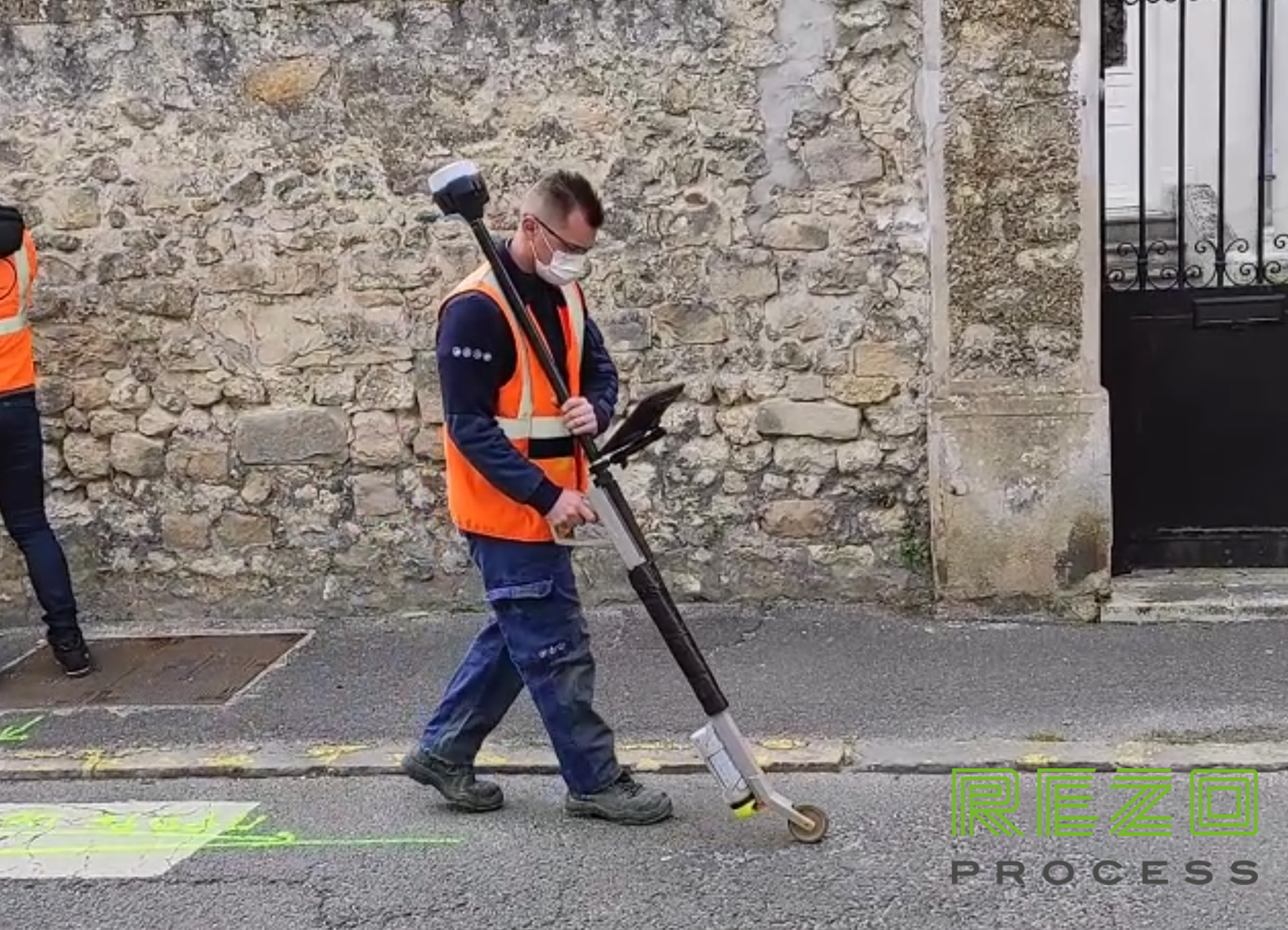
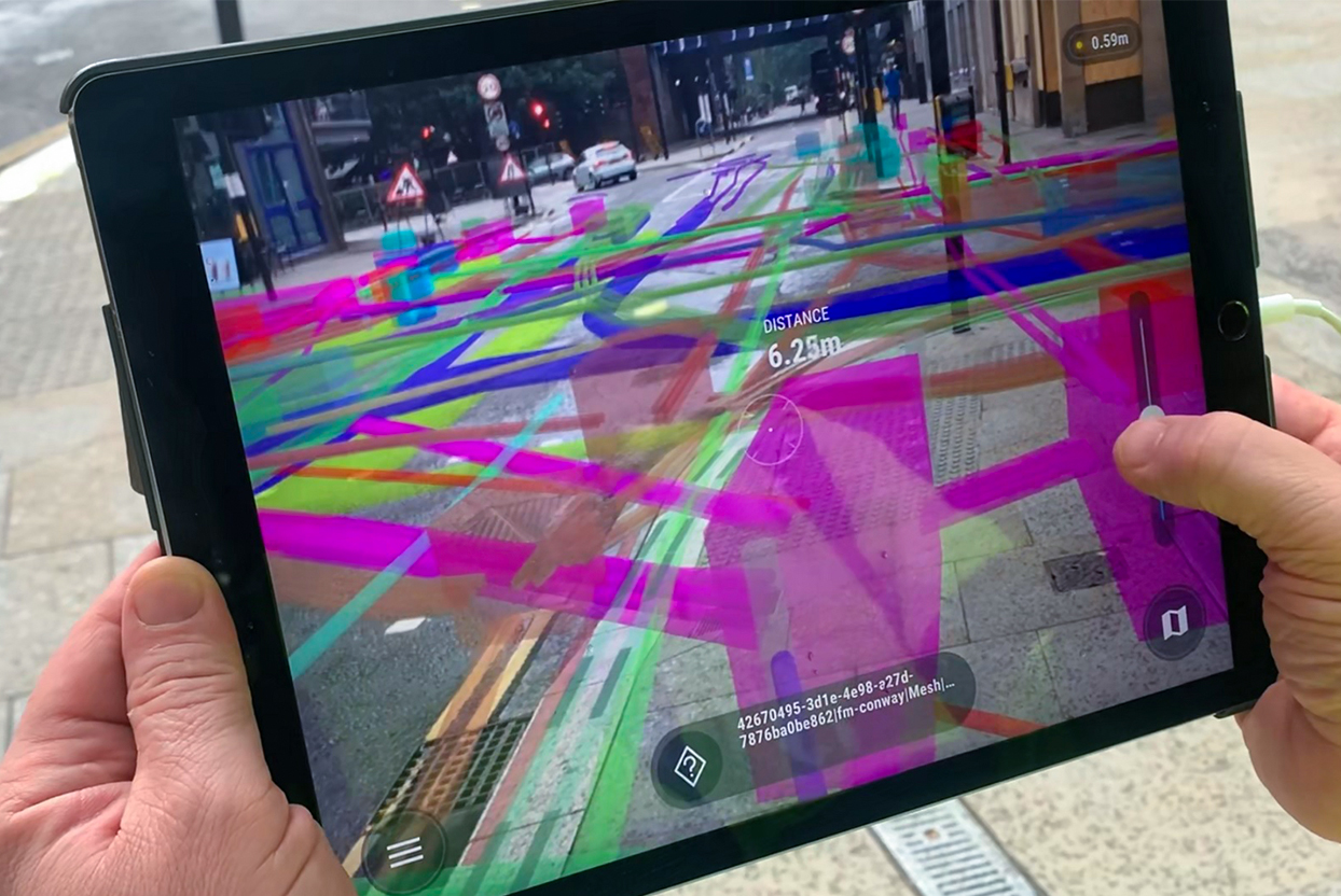
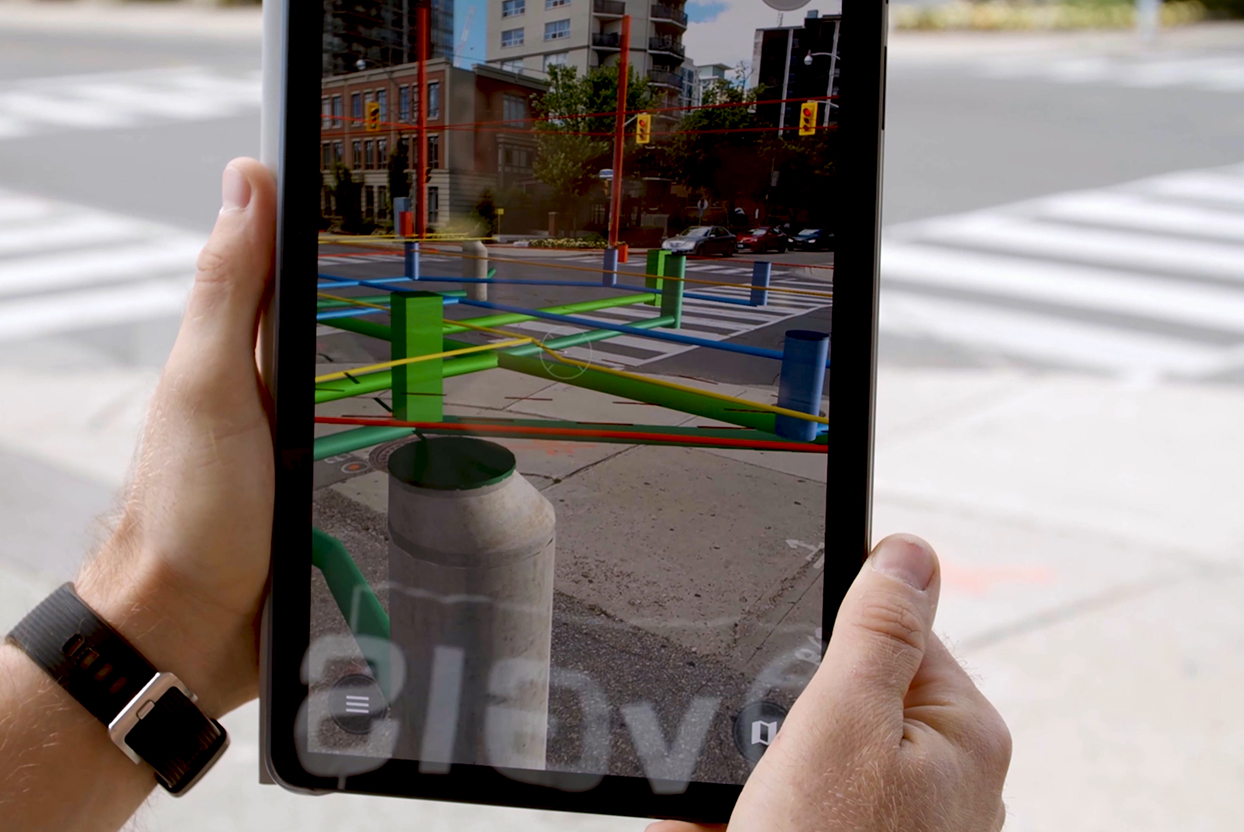
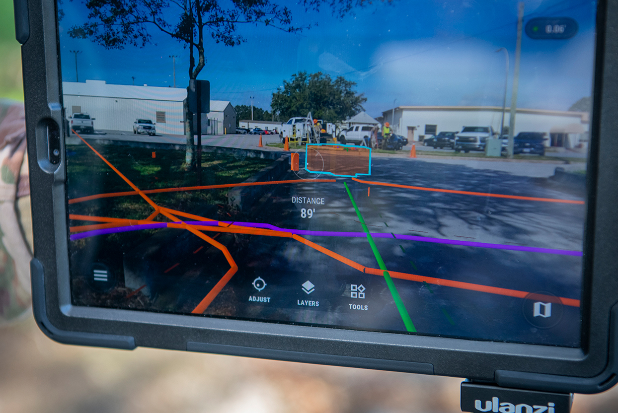
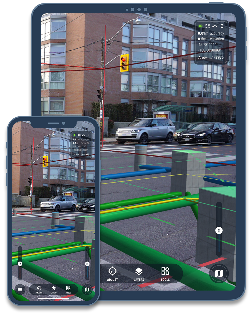
Document: Quickly and accurately document utility locates using your phone or tablet. Create detailed 3D scans or draw precise markings with augmented reality tools.
Report: Share highly detailed 3D views of the site and generate professional PDF reports with just a few clicks.
Visualize: Reduce time spent locating by using augmented reality to display known utilities. Reuse previous locates for confident re-marking and faster workflows.
Click the button below to view a sample Locate Report with:
| Live Demo |
less time spent on locate documentation
with simple and affordable pricing
saved monthly per locator
time savings on repeat locate jobs
Streamline your utility locates documentation with vSite for Locates. Reduce the time required to produce highly detailed reports to a fraction of the time it usually takes to document your jobs.
vSite AR (originally called "Meemim App") and how it's deployed by utility locators.