Platform for Utility Construction
All your utility project data and field tools unified in one platform. vSite delivers visual, real-time insights into what’s built and where, so utility contractors and owners can work safer, faster, and smarter.

All your utility project data and field tools unified in one platform. vSite delivers visual, real-time insights into what’s built and where, so utility contractors and owners can work safer, faster, and smarter.
A smarter way to manage utility and infrastructure projects: from planning through handover.
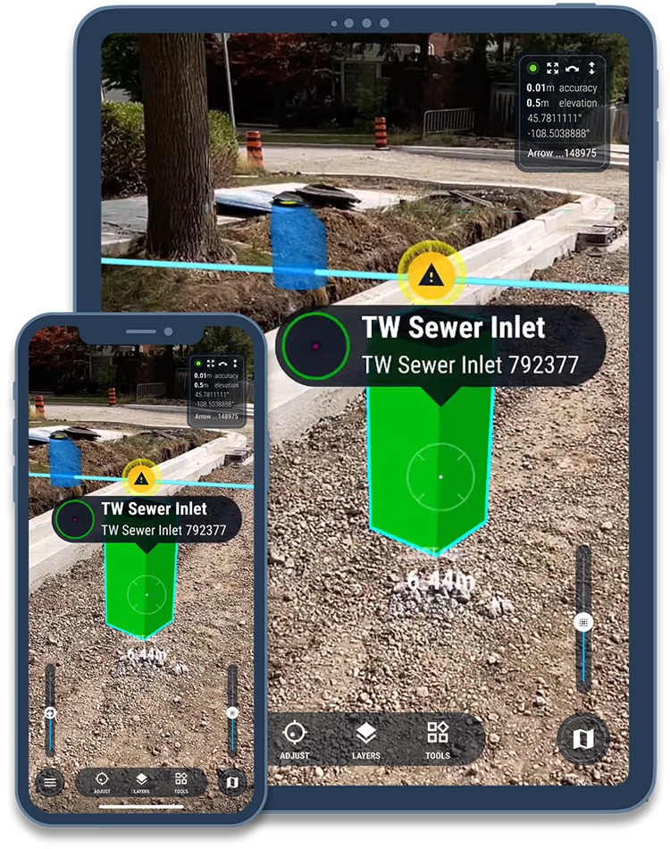
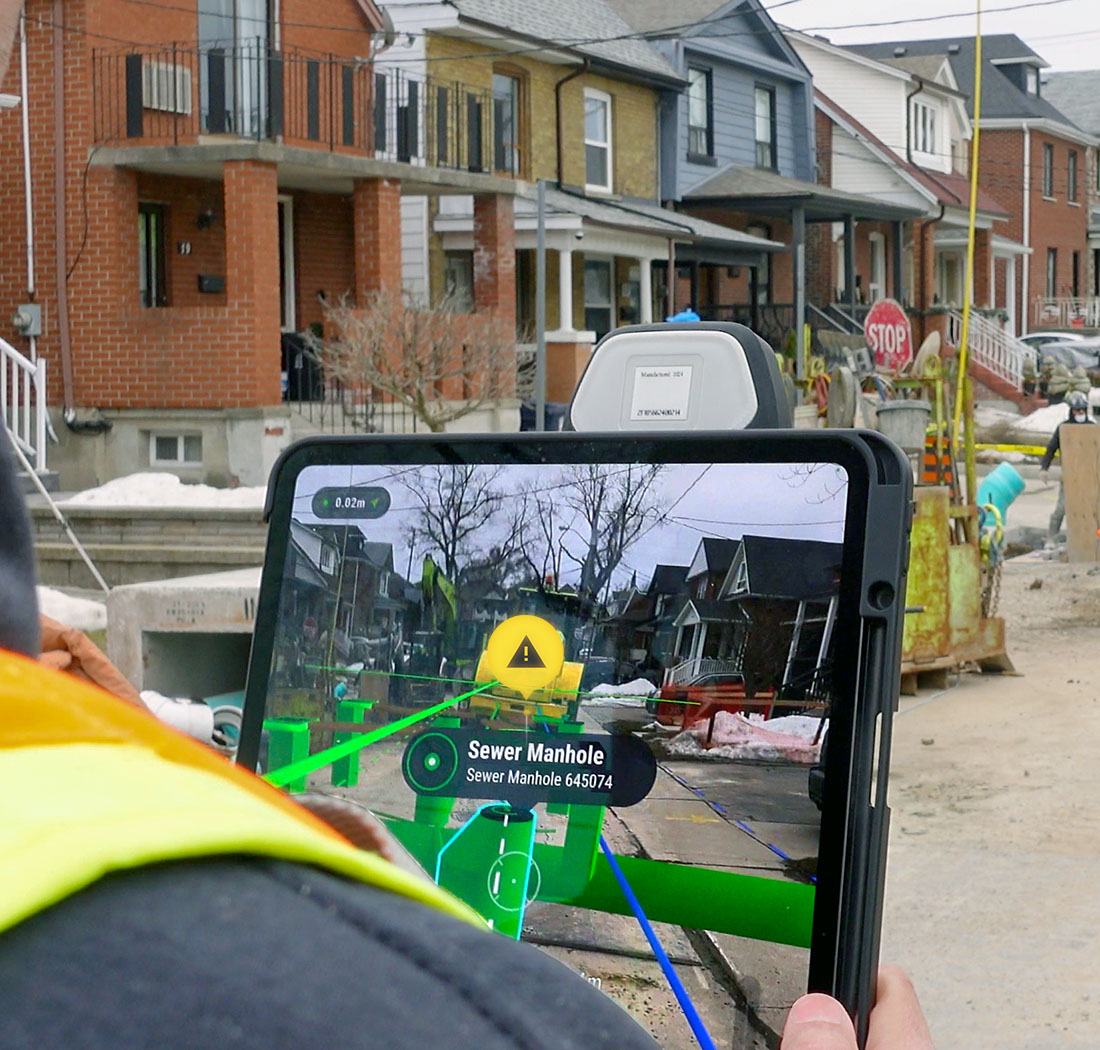
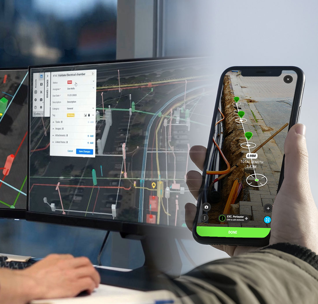
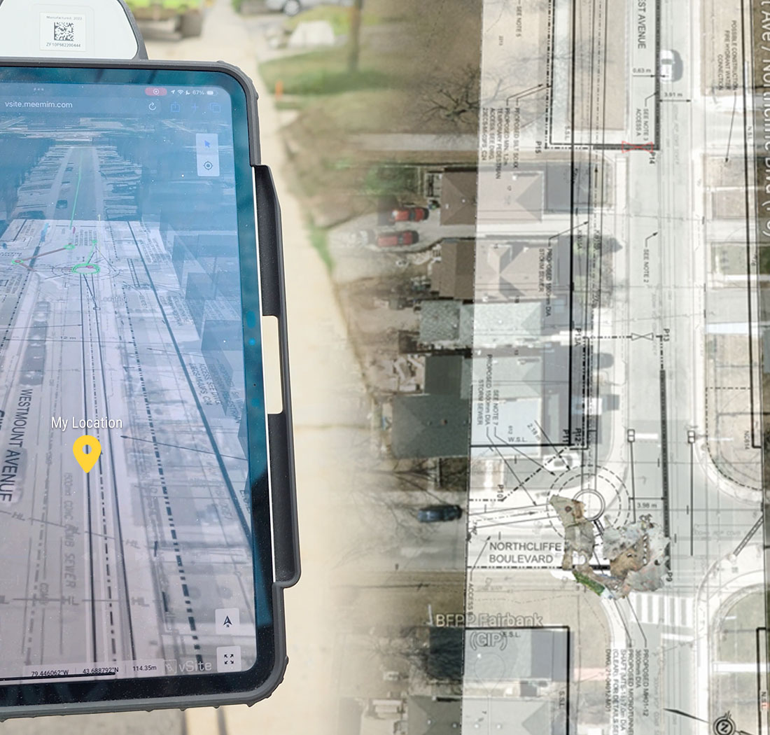
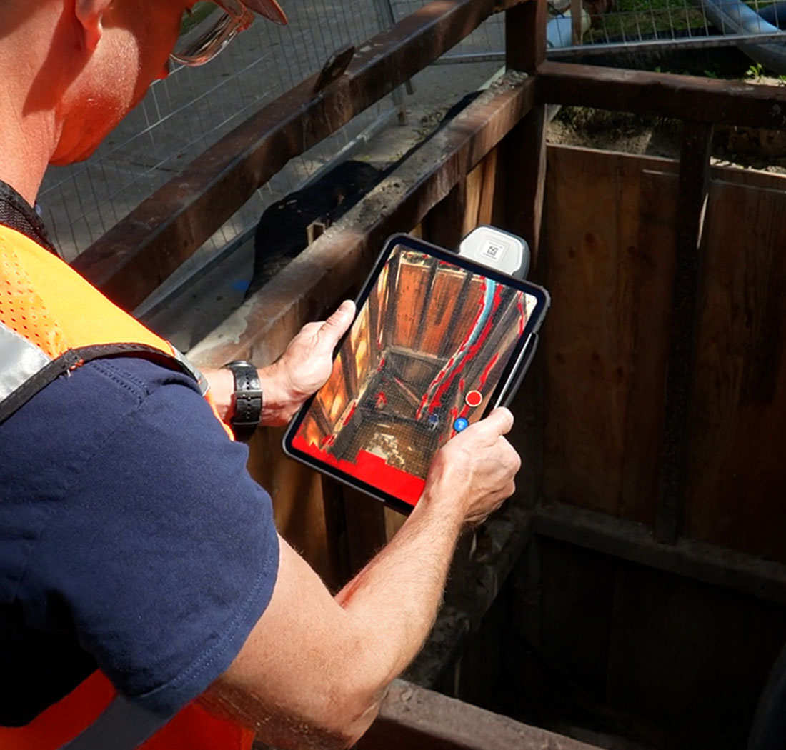
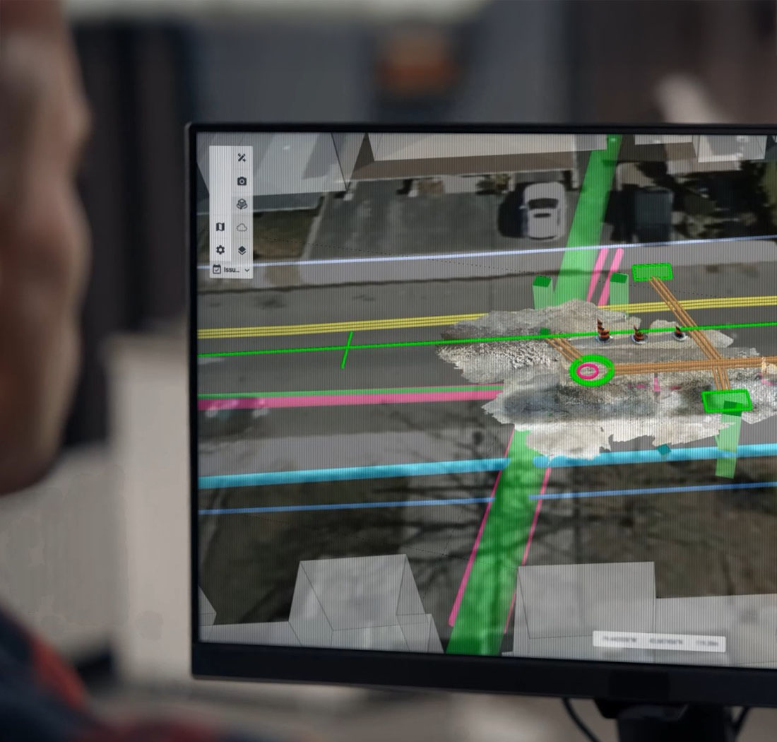
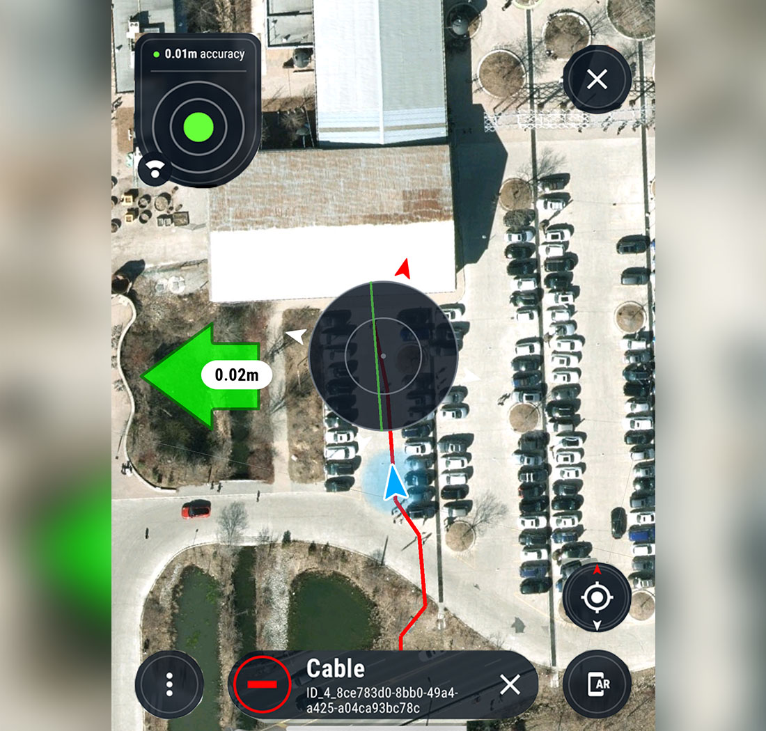
vSite brings together everything that happens on the jobsite into a single, real-time view. Built for utility construction, it combines AI, accurate as-built capture, and construction-grade AR to create a live digital twin that reflects exactly what’s installed, where, and when.
vSite integrates seamlessly with Autodesk® Construction Cloud, Bentley® ProjectWise, and Esri® ArcGIS. Whether you’re managing field operations or coordinating from the office, vSite connects your data and teams in real time—reducing errors, rework, and delays.
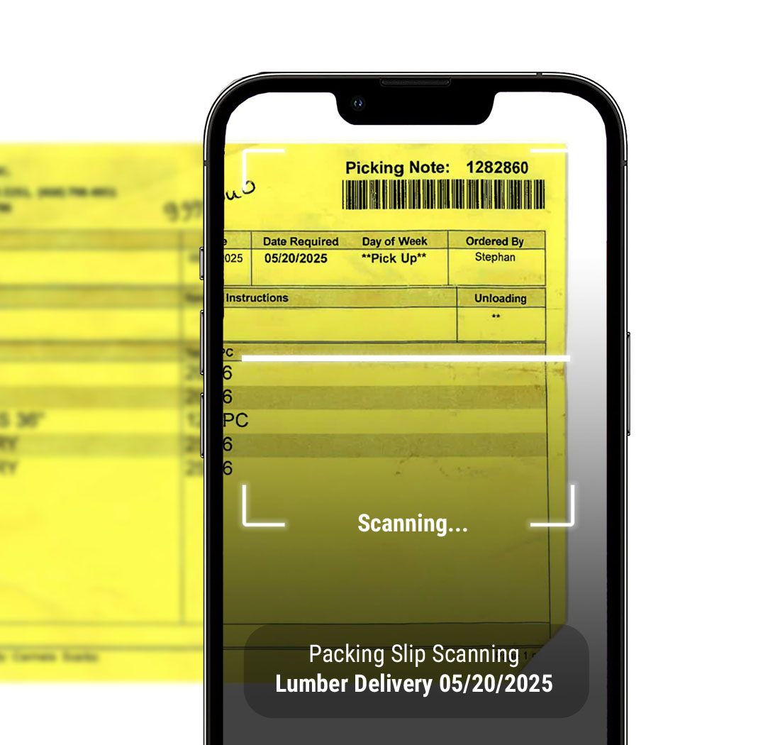
vSite includes all the tools needed to run a modern utility construction project: from clash detection and documenting locates to generating daily reports and tracking quantities.
Instead of juggling 4 to 8 different apps and systems, teams get one streamlined platform where everything works together out of the box. This reduces training time, simplifies support, and lowers the total cost of ownership.
vSite is designed specifically for the real-world needs of utility construction. It’s a complete solution for:
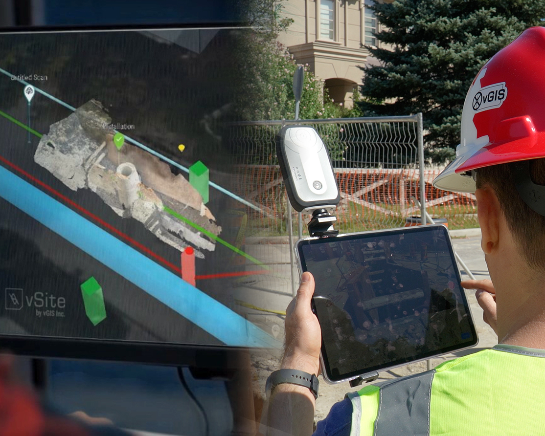
Site fits into your workflow, not the other way around. Whether you’re scanning a trench, pulling up drawings, or redline, vSite works the way your team already does.
Technical details:
vSite products and features:
Lower costs and fewer strikes
Less admin time and overhead